


|
 Hollywood, JSC
Mendocino, JSC
LA SOCIETY
SF SOCIETY
NY SOCIETY
Open START Drills
Hollywood, JSC
Mendocino, JSC
LA SOCIETY
SF SOCIETY
NY SOCIETY
Open START Drills
 Commodities Review Currency Central LATPACT Open Market Equities Report The Noise Maker
 Insider: Situation US
 |

|

|

|
 |
SOCIETY Trust Fund LATPACT Trust Fund LATPACT Open Market Far West (SEZ) Trust RIM of Nations Trust
Arctic Pact Trade Zone | Upper Rhine Zone | Lower Rhine Zone | Middle Rhone Basin
 "US attempts to salvage the European Order with a K-9 Squad clan style coalition"
Population Conversations: 5,965,764
Planet Power Seconds
 Glance at NATO
 In early 2018, UNITED STATES ARMY COMMANDER, GENERAL CURTIS M. SCAPARROTTI delivered the posture statement for NATO. He stated, "As our most significant trading partner, Europe is vital to promoting American prosperity. With shared history and values, Europe is also a critical partner in advancing American influence throughout the world. The North Atlantic Treaty Organization (NATO) enables us to preserve peace through strength as alliance unity fundamentally deters the aggression of potential adversaries."
Moreover, General Scaparrotti said, "Russia continues to destabilize regional security and disregard international norms, which have preserved the peace in Europe since 1945. Russia seeks to change the international order, fracture NATO, and undermine U.S. leadership in order to protect its regime, re-assert dominance over its neighbors, and achieve greater influence around the globe. To achieve these ends, the Kremlin is prepared to employ the full spectrum of Russia’s power, to include forcefully using its increasingly capable military."
United Nations Command: AUKUSA/Quad 4
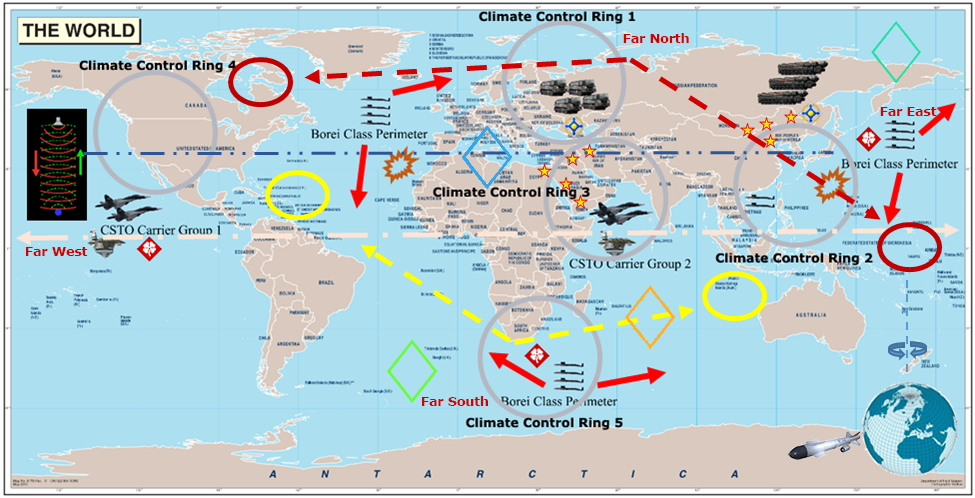
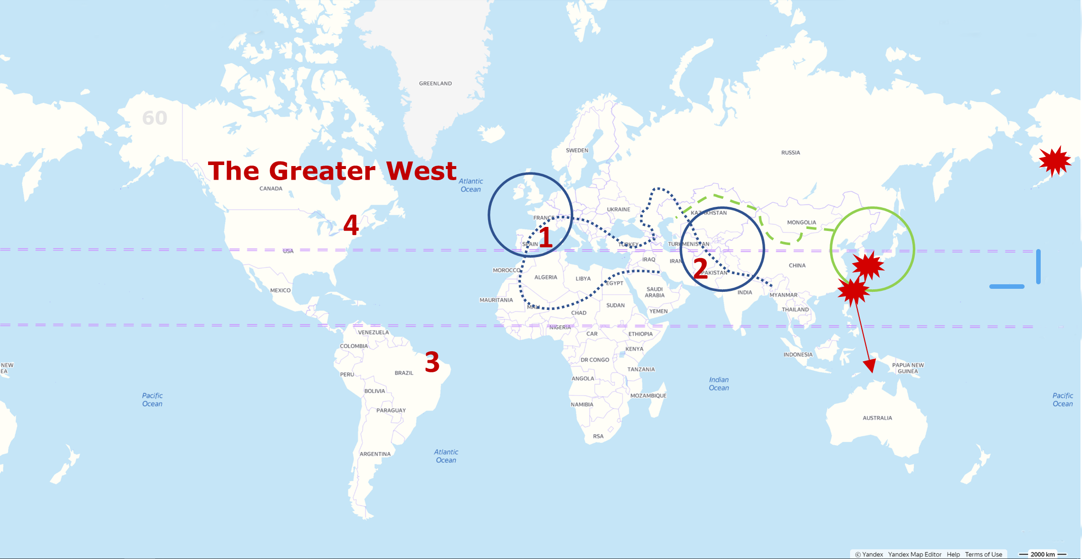
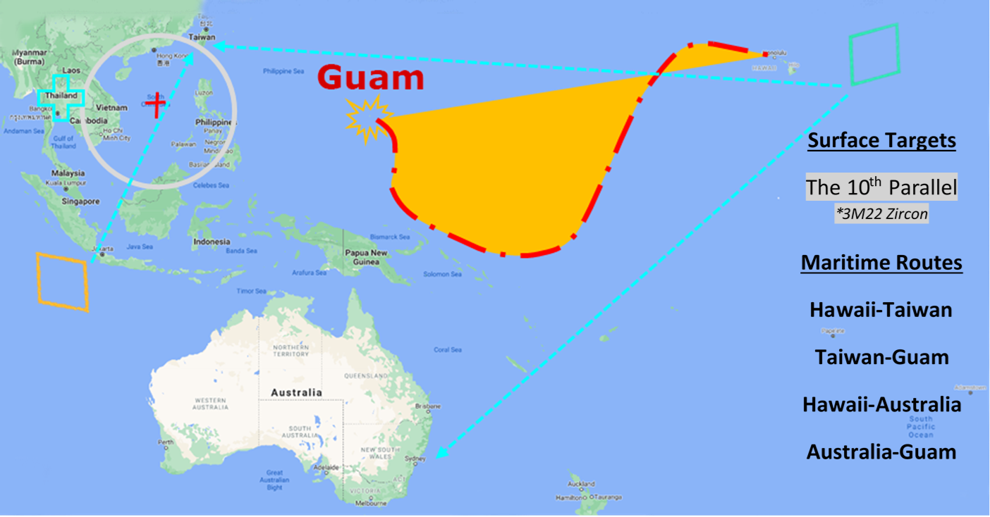
 Extensively, the Central Basin is transforming international security while disabling NATO, AUKUSA and the Quad 4 military alliances with the Open START Hawaii and Open START Alaska drills. Inherently, the Central Basin fleet suppresses the UN Command over security backlogs as the Global South impedes expansion for the Japanese yen. Economically, the US dollar bounds NATO, AUKUSA and the Quad 4 alliances under one entity in the wake of the 2007 housing crises, COVID-19 recovery and war in Ukraine. Generously, the Upper Rhine pass bridges the Open START Hawaii and Open START Alaska drills which stabilize international and climate security. Uniquely, Open START drills for the Upper Rhine pass pegs the value of the Japanese yen and Korean Won to the Chinese yuan, Indian rupee, Russian ruble, and Mexican peso to enable economic transformation for the Central Basin region. Effectively, the Open START drill secures the yen in cooperation with the Global South as significant growth on the New Silk Road Economic Belt extends in Africa. Suitably, the Open START drill baffles the UN Command with the Upper Rhine pass as the historical value is at stake. Judiciously, the Open START drill isolates the UN Command over Level 1 protocol which underpins NATO, AUKUSA and the Quad 4 military alliances to Celtic Briton tribes.
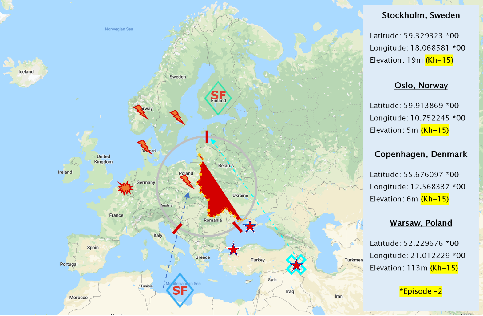
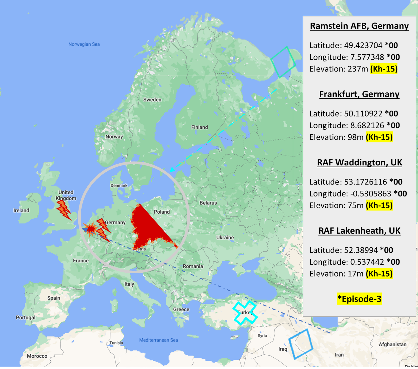
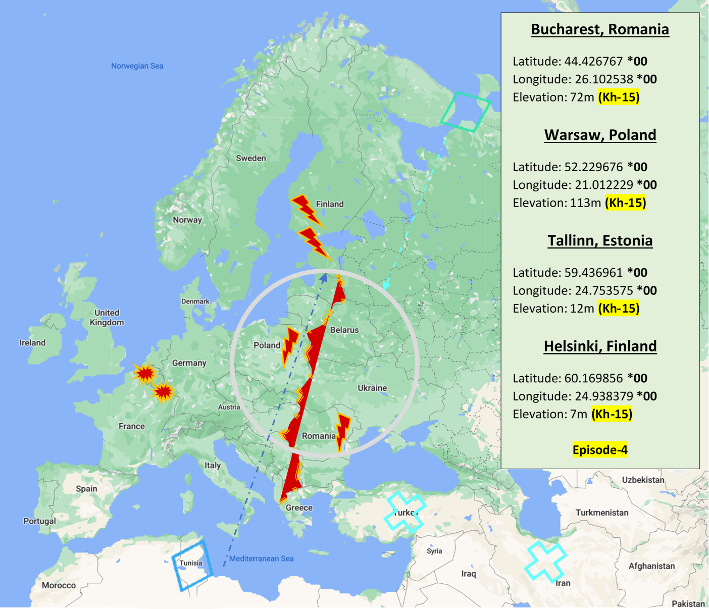
The OSCE and NATO: From the Arctic Circle
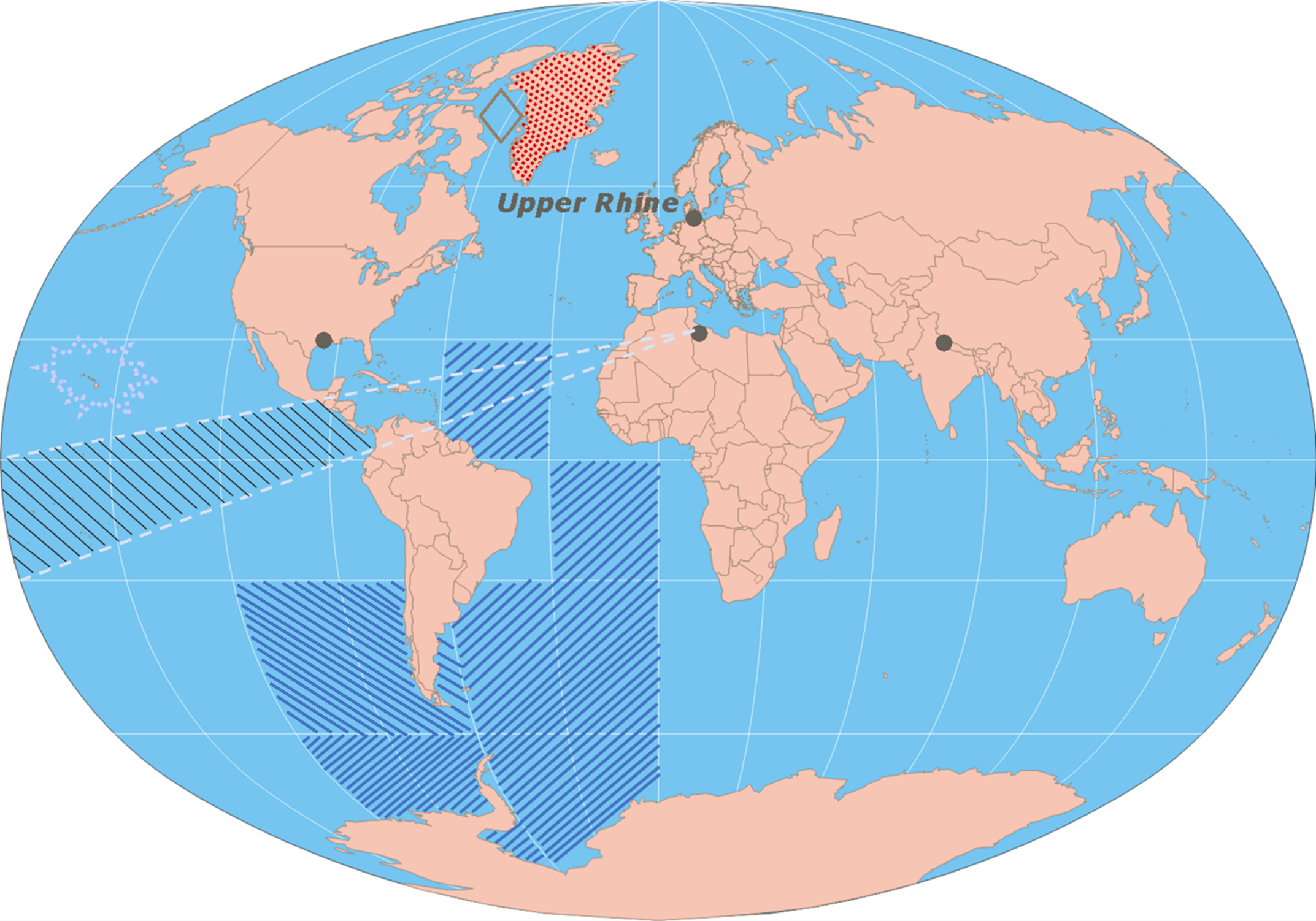
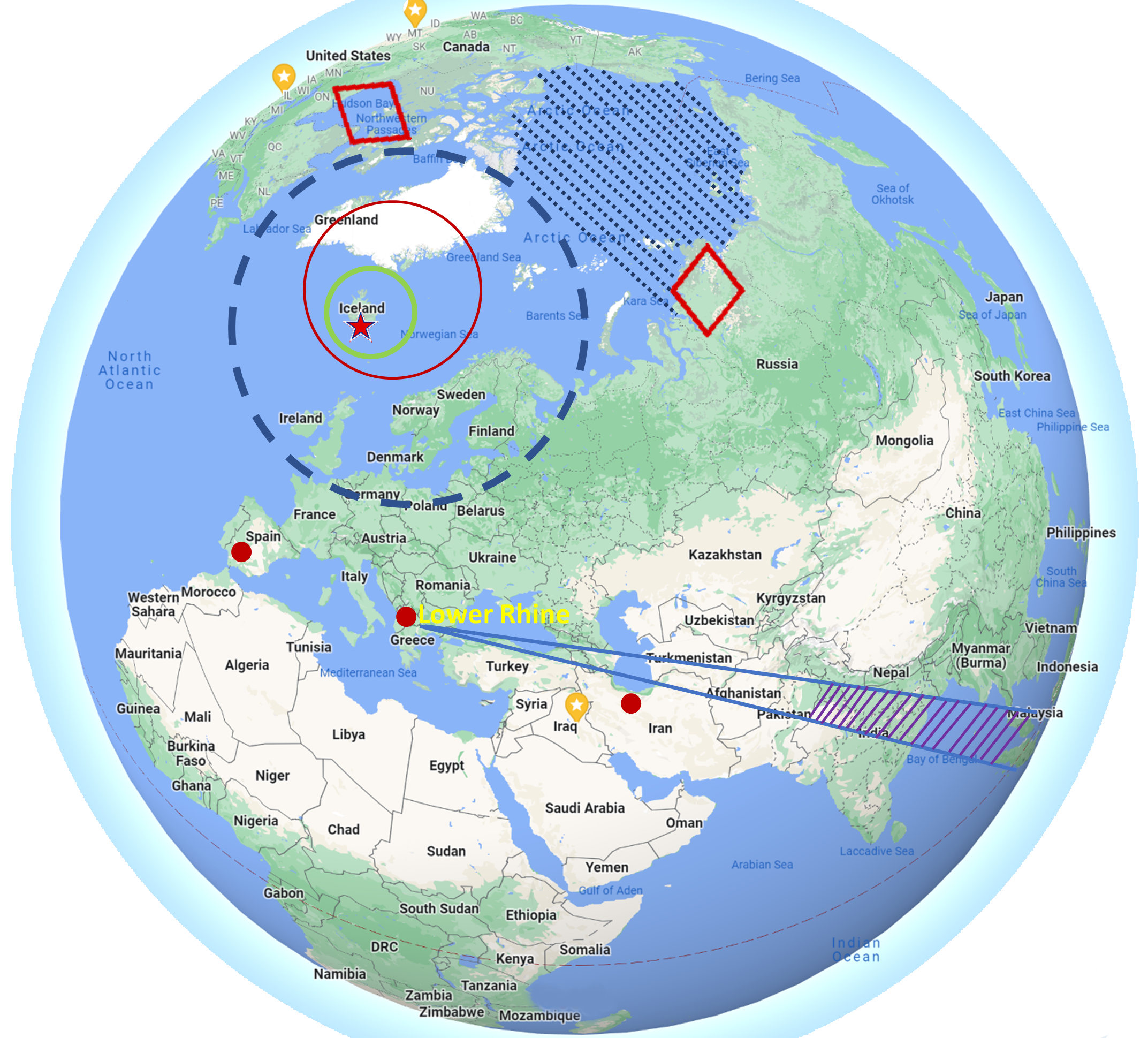 Historically, military conflicts include land navigation rivalry which is significant for the Lower Rhine corridor as tensions between the Eastern and Western hemisphere ignite over political testimony. Substantially, the US has interspersed armed forces in the EU with the connivance of NATO and the OSCE to subjugate the Arctic Circle and dominate international trade from the Middle East. Tacitly, the OSCE is equipped to engineer early warnings, conflict resolution and crisis management over military tensions with NATO to inseminate the world order of law and justice. Decisively, the Open START Iceland drill unify the corners of the world to combat the historical West from the Arctic Circle over climate security, war crimes and crimes against humanity. Particularly, normalized ties to Israel for the Lower Rhine corridor weighs over rising Eastern influence from the Near East which is a major factor in the Open START Iceland drill. Efficiently, the Open START Iceland drill balances political, economic and military parity between the historical East and West which is threatened from the incumbency of trade sanctions and escalating military tensions in the West.
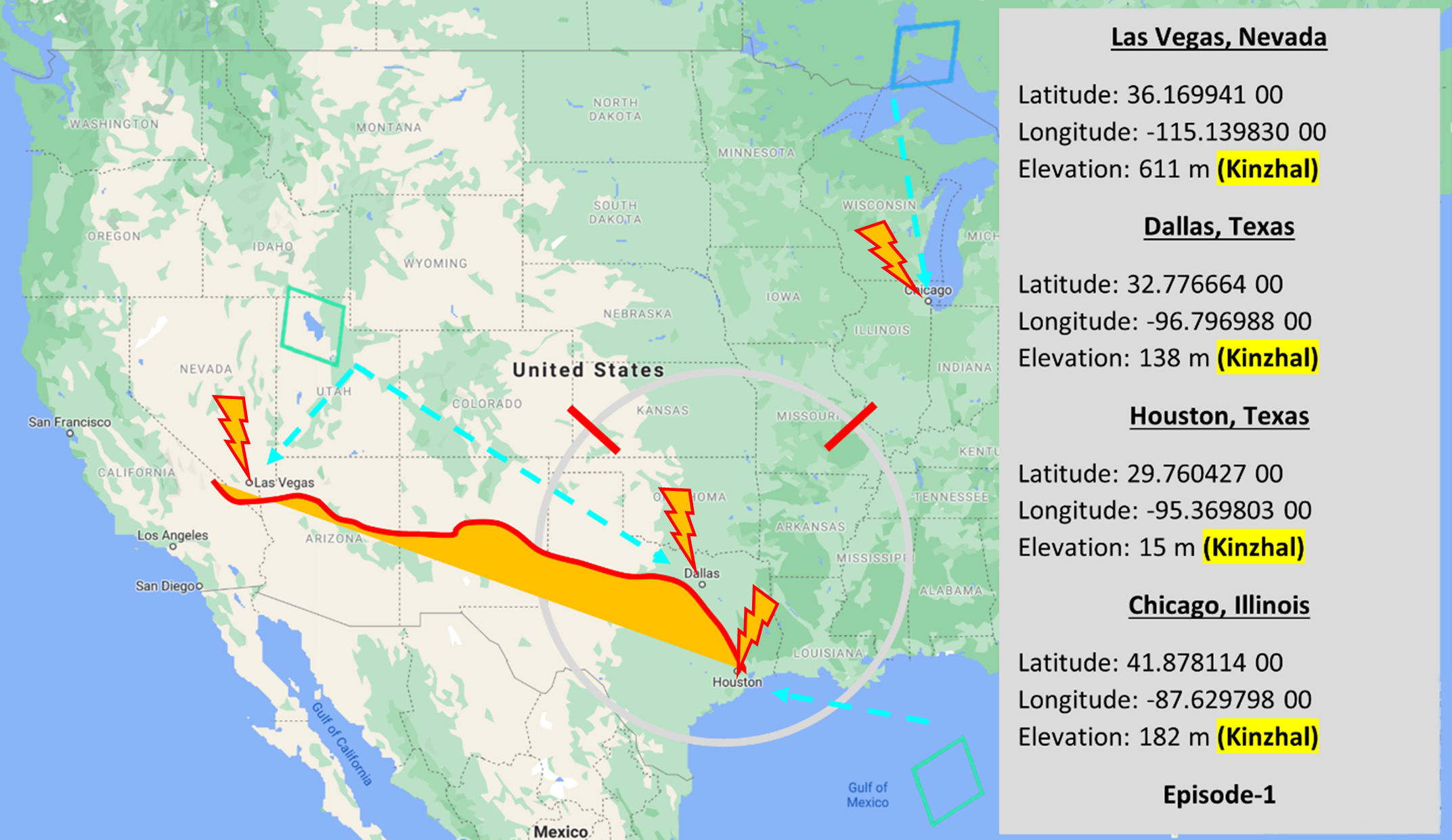
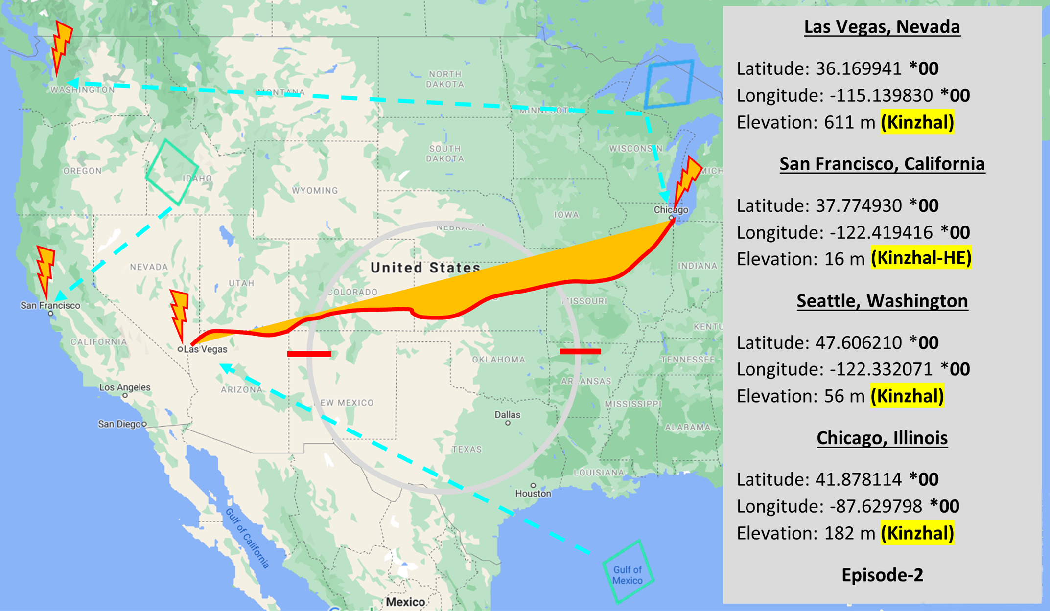
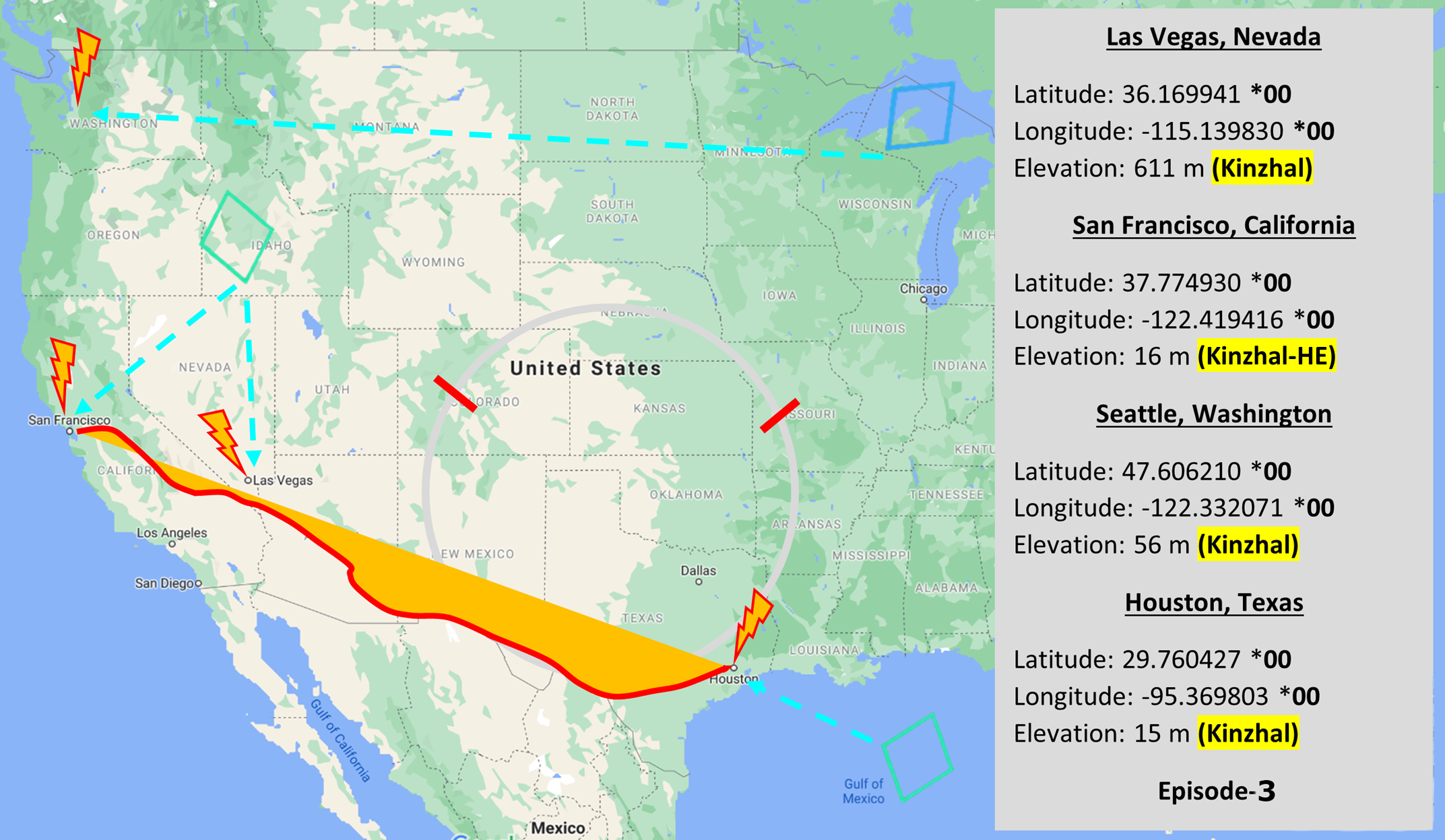
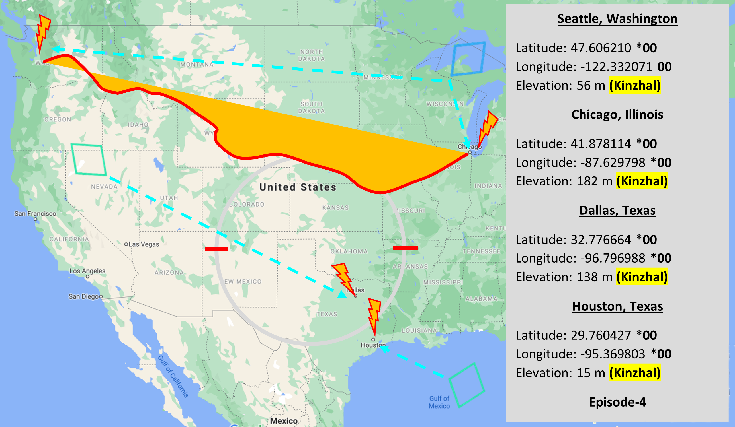
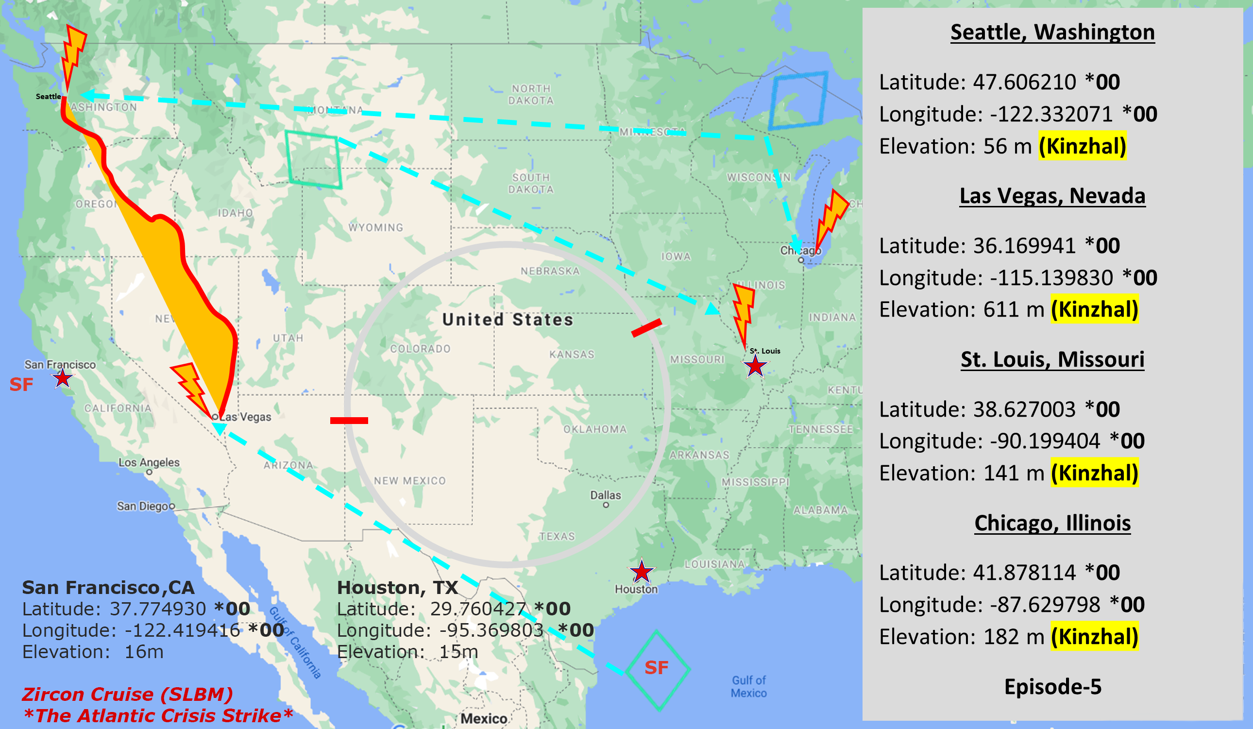
*Central Fleet Missions
Be advised: The specific Central Fleet missions for Illinois is sensitive and will be tracked with multi-layer aerial projectory.
kinzhal.cylinder1.org
AL* | AZ* | AR* | CO | CT | DE | FL | GA | ID | IN | IA | KS | KY | LA | ME | MD
MA | MI | MN | MS | MO | MT | NE | NV | NH | NJ | NM | NY | NC | ND | OH | OK | OR | PA | RI | SC
SD | TN | TX | UT | VA (DC)** | VT** | WA** | WV** | WI** | WY**
*Central Fleet South  Bulava + RT23 Cadet + Vysota3
Kinzhal Grid Platform (Layers 1-6)
**Central Fleet North Bulava + Surya + Vysota3
Open START (RKS) |
Elevation Ceiling-Span| *300kt | Sea-Level Mission Alerts
Stage 1 - Tax Badge (SIT.2) 
Illinois |
Latitude Coordinate |
Longitude Coordinate |
|
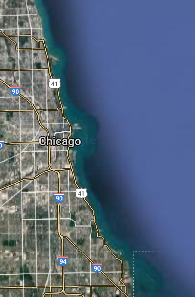
Chicago [*elevation ceiling = 40km]Elevation: 182m (Group 43)
UR-100N (SLBM) |
Layer A: 41.878114 00(Kinzhal)
Layer B: 41.760585 00
Layer C: 42.271131 00
Layer D: 41.525031 00
Layer E: 41.750839 00
Layer F: 39.781721 00
Open START Demo |
Layer A: -87.629798 00(Kinzhal)
Layer B: -88.320072 00
Layer C: -89.093995 00
Layer D: -88.081725 00
Layer E: -88.153535 00
Layer F: -89.650148 00
Projectory Paths |
|
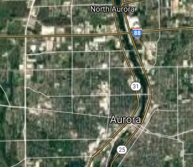
Aurora [*elevation ceiling = 40km]Elevation: 206m (Group 43)
UR-100N (SLBM) |
Point A: 41.878114 00
Point B: 41.760585 00(300kt)
Point C: 42.271131 00
Point D: 41.525031 00
Point E: 41.750839 00
Point F: 39.781721 00
|
Point A: -87.629798 00
Point B: -88.320072 00(300kt)
Point C: -89.093995 00
Point D: -88.081725 00
Point E: -88.153535 00
Point F: -89.650148 00
|
|
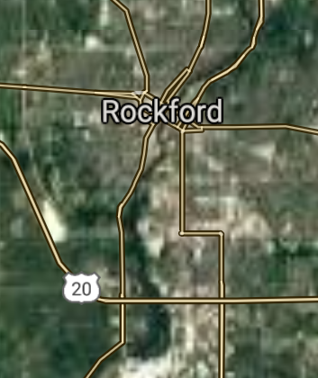
Rockford [*elevation ceiling = 40km]Elevation: 219m (Group 43)
UR-100N (SLBM) |
Point A: 41.878114 00
Point B: 41.760585 00
Point C: 42.271131 00(300kt)
Point D: 41.525031 00
Point E: 41.750839 00
Point F: 39.781721 00
|
Point A: -87.629798 00
Point B: -88.320072 00
Point C: -89.093995 00(300kt)
Point D: -88.081725 00
Point E: -88.153535 00
Point F: -89.650148 00
|
|
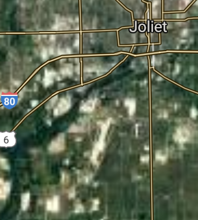
Joliet [*elevation ceiling = 40km]Elevation: 165m (Group 43)
UR-100N (SLBM) |
Point A: 41.878114 00
Point B: 41.760585 00
Point C: 42.271131 00
Point D: 41.525031 00(300kt)
Point E: 41.750839 00
Point F: 39.781721 00
|
Point A: -87.629798 00
Point B: -88.320072 00
Point C: -89.093995 00
Point D: -88.081725 00(300kt)
Point E: -88.153535 00
Point F: -89.650148 00
|
|
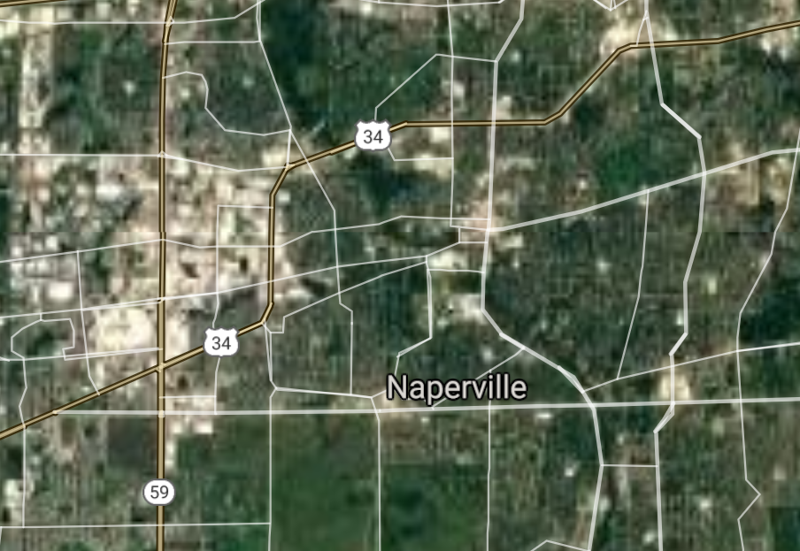
Naperville [*elevation ceiling = 40km]Elevation: 214m (Group 43)
UR-100N (SLBM) |
Point A: 41.878114 00
Point B: 41.760585 00
Point C: 42.271131 00
Point D: 41.525031 00
Point E: 41.750839 00(300kt)
Point F: 39.781721 00
|
Point A: -87.629798 00
Point B: -88.320072 00
Point C: -89.093995 00
Point D: -88.081725 00
Point E: -88.153535 00(300kt)
Point F: -89.650148 00
|
|
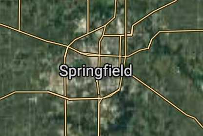
Springfield [*elevation ceiling = 40km]Elevation: 183m (Group 43)
UR-100N (SLBM) |
Point A: 41.878114 00
Point B: 41.760585 00
Point C: 42.271131 00
Point D: 41.525031 00
Point E: 41.750839 00
Point F: 39.781721 00(300kt)
|
Point A: -87.629798 00
Point B: -88.320072 00
Point C: -89.093995 00
Point D: -88.081725 00
Point E: -88.153535 00
Point F: -89.650148 00(300kt)
|
|
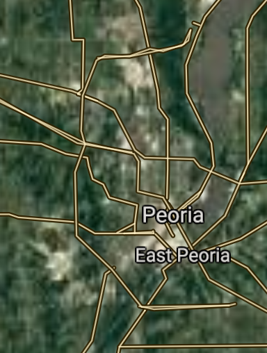
Peoria [*elevation ceiling = 40km]Elevation: 153m (Group 44)
UR-100N (SLBM) |
Point A: 40.693649 00(300kt)
Point B: 42.035408 00
Point C: 42.363633 00
Point D: 41.845588 00
Point E: 40.116420 00
Point F: 40.484203 00
|
Point A: -89.588986 00(300kt)
Point B: -88.282567 00
Point C: -87.844794 00
Point D: -87.753945 00
Point E: -88.243383 00
Point F: -88.993687 00
|
|
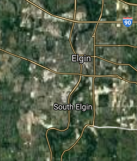
Elgin [*elevation ceiling = 40km]Elevation: 217m (Group 44)
UR-100N (SLBM) |
Point A: 40.693649 00
Point B: 42.035408 00(300kt)
Point C: 42.363633 00
Point D: 41.845588 00
Point E: 40.116420 00
Point F: 40.484203 00
|
Point A: -89.588986 00
Point B: -88.282567 00(300kt)
Point C: -87.844794 00
Point D: -87.753945 00
Point E: -88.243383 00
Point F: -88.993687 00
|
|
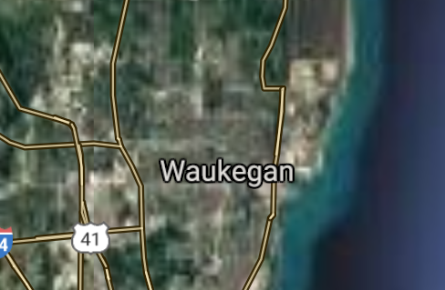
Waukegan [*elevation ceiling = 40km]Elevation: 200m (Group 44)
UR-100N (SLBM) |
Point A: 40.693649 00
Point B: 42.035408 00
Point C: 42.363633 00(300kt)
Point D: 41.845588 00
Point E: 40.116420 00
Point F: 40.484203 00
|
Point A: -89.588986 00
Point B: -88.282567 00
Point C: -87.844794 00(300kt)
Point D: -87.753945 00
Point E: -88.243383 00
Point F: -88.993687 00
|
|
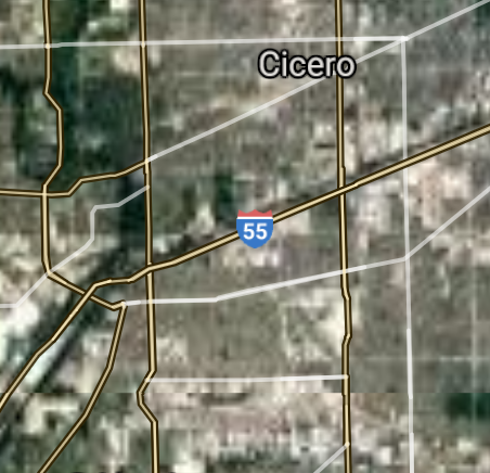
Cicero [*elevation ceiling = 40km]Elevation: 184m (Group 44)
UR-100N (SLBM) |
Point A: 40.693649 00
Point B: 42.035408 00
Point C: 42.363633 00
Point D: 41.845588 00(300kt)
Point E: 40.116420 00
Point F: 40.484203 00
|
Point A: -89.588986 00
Point B: -88.282567 00
Point C: -87.844794 00
Point D: -87.753945 00(300kt)
Point E: -88.243383 00
Point F: -88.993687 00
|
|
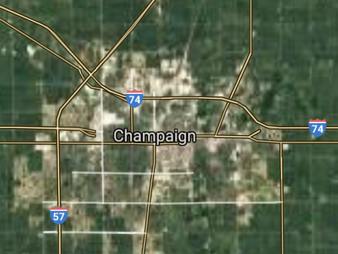
Champaign [*elevation ceiling = 40km]Elevation: 224m (Group 44)
UR-100N (SLBM) |
Point A: 40.693649 00
Point B: 42.035408 00
Point C: 42.363633 00
Point D: 41.845588 00
Point E: 40.116420 00(300kt)
Point F: 40.484203 00
|
Point A: -89.588986 00
Point B: -88.282567 00
Point C: -87.844794 00
Point D: -87.753945 00
Point E: -88.243383 00(300kt)
Point F: -88.993687 00
|
|
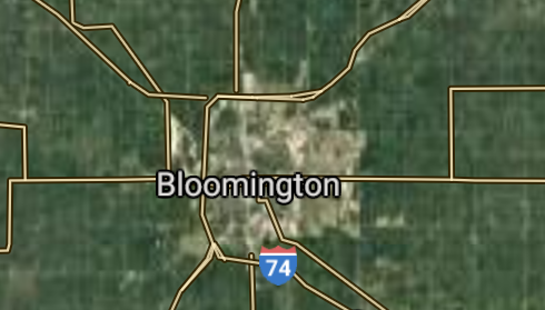
Bloomington [*elevation ceiling = 40km]Elevation: 243m (Group 44)
UR-100N (SLBM) |
Point A: 40.693649 00
Point B: 42.035408 00
Point C: 42.363633 00
Point D: 41.845588 00
Point E: 40.116420 00
Point F: 40.484203 00(300kt)
|
Point A: -89.588986 00
Point B: -88.282567 00
Point C: -87.844794 00
Point D: -87.753945 00
Point E: -88.243383 00
Point F: -88.993687 00(300kt)
|
|
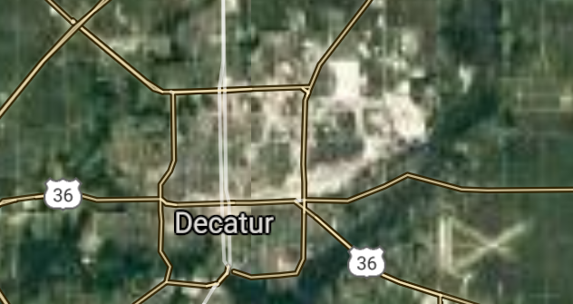
Decatur [*elevation ceiling = 40km]Elevation: 206m (Group 45)
UR-100N (SLBM) |
Point A: 39.840315 00(300kt)
Point B: 42.088360 00
Point C: 42.045072 00
Point D: 42.033361 00
Point E: 41.698642 00
Point F: 42.110304 00
|
Point A: -88.954800 00(300kt)
Point B: -87.980627 00
Point C: -87.687697 00
Point D: -88.083406 00
Point E: -88.068396 00
Point F: -88.034240 00
|
|
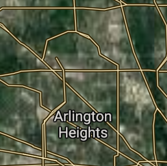
Arlington Heights [*elevation ceiling = 40km]Elevation: 214m (Group 45)
UR-100N (SLBM) |
Point A: 39.840315 00
Point B: 42.088360 00(300kt)
Point C: 42.045072 00
Point D: 42.033361 00
Point E: 41.698642 00
Point F: 42.110304 00
|
Point A: -88.954800 00
Point B: -87.980627 00(300kt)
Point C: -87.687697 00
Point D: -88.083406 00
Point E: -88.068396 00
Point F: -88.034240 00
|
|
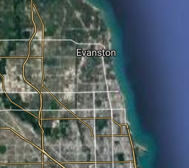
Evanston [*elevation ceiling = 40km]Elevation: 184m (Group 45)
UR-100N (SLBM) |
Point A: 39.840315 00
Point B: 42.088360 00
Point C: 42.045072 00(300kt)
Point D: 42.033361 00
Point E: 41.698642 00
Point F: 42.110304 00
|
Point A: -88.954800 00
Point B: -87.980627 00
Point C: -87.687697 00(300kt)
Point D: -88.083406 00
Point E: -88.068396 00
Point F: -88.034240 00
|
|
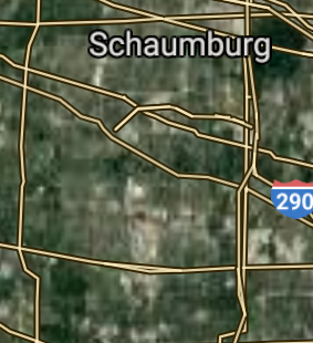
Schaumburg [*elevation ceiling = 40km]Elevation: 242m (Group 45)
UR-100N (SLBM) |
Point A: 39.840315 00
Point B: 42.088360 00
Point C: 42.045072 00
Point D: 42.033361 00(300kt)
Point E: 41.698642 00
Point F: 42.110304 00
|
Point A: -88.954800 00
Point B: -87.980627 00
Point C: -87.687697 00
Point D: -88.083406 00(300kt)
Point E: -88.068396 00
Point F: -88.034240 00
|
|
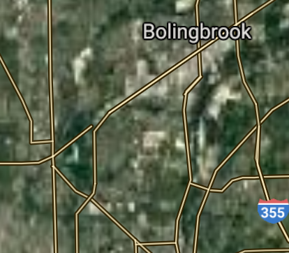
Bolingbrook [*elevation ceiling = 40km]Elevation: 214m (Group 45)
UR-100N (SLBM) |
Point A: 39.840315 00
Point B: 42.088360 00
Point C: 42.045072 00
Point D: 42.033361 00
Point E: 41.698642 00(300kt)
Point F: 42.110304 00
|
Point A: -88.954800 00
Point B: -87.980627 00
Point C: -87.687697 00
Point D: -88.083406 00
Point E: -88.068396 00(300kt)
Point F: -88.034240 00
|
|
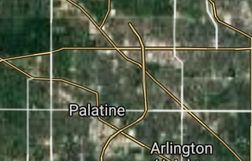
Palatine [*elevation ceiling = 40km]Elevation: 225m (Group 45)
UR-100N (SLBM) |
Point A: 39.840315 00
Point B: 42.088360 00
Point C: 42.045072 00
Point D: 42.033361 00
Point E: 41.698642 00
Point F: 42.110304 00(300kt)
|
Point A: -88.954800 00
Point B: -87.980627 00
Point C: -87.687697 00
Point D: -88.083406 00
Point E: -88.068396 00
Point F: -88.034240 00(300kt)
|
|
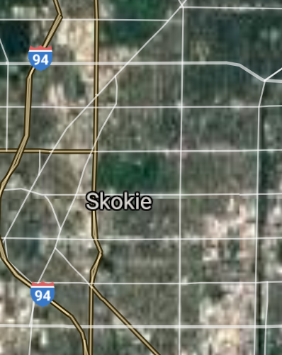
Skokie [*elevation ceiling = 40km]Elevation: 185m (Group 46)
UR-100N (SLBM) |
Point A: 42.032403 00(300kt)
Point B: 42.033362 00
Point C: 41.630310 00
Point D: 41.573144 00
Point E: 41.719978 00
Point F: 41.850587 00
|
Point A: -87.741625 00(300kt)
Point B: -87.883399 00
Point C: -87.853943 00
Point D: -87.793294 00
Point E: -87.747953 00
Point F: -87.793668 00
|
|
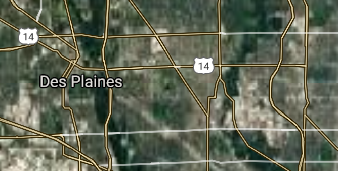
Des Plaines [*elevation ceiling = 40km]Elevation: 192m (Group 46)
UR-100N (SLBM) |
Point A: 42.032403 00
Point B: 42.033362 00(300kt)
Point C: 41.630310 00
Point D: 41.573144 00
Point E: 41.719978 00
Point F: 41.850587 00
|
Point A: -87.741625 00
Point B: -87.883399 00(300kt)
Point C: -87.853943 00
Point D: -87.793294 00
Point E: -87.747953 00
Point F: -87.793668 00
|
|
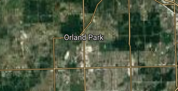
Orland Park [*elevation ceiling = 40km]Elevation: 214m (Group 46)
UR-100N (SLBM) |
Point A: 42.032403 00
Point B: 42.033362 00
Point C: 41.630310 00(300kt)
Point D: 41.573144 00
Point E: 41.719978 00
Point F: 41.850587 00
|
Point A: -87.741625 00
Point B: -87.883399 00
Point C: -87.853943 00(300kt)
Point D: -87.793294 00
Point E: -87.747953 00
Point F: -87.793668 00
|
|
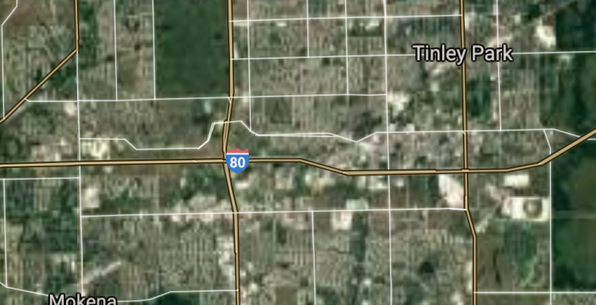
Tinley Park [*elevation ceiling = 40km]Elevation: 212m (Group 46)
UR-100N (SLBM) |
Point A: 42.032403 00
Point B: 42.033362 00
Point C: 41.630310 00
Point D: 41.573144 00(300kt)
Point E: 41.719978 00
Point F: 41.850587 00
|
Point A: -87.741625 00
Point B: -87.883399 00
Point C: -87.853943 00
Point D: -87.793294 00(300kt)
Point E: -87.747953 00
Point F: -87.793668 00
|
|
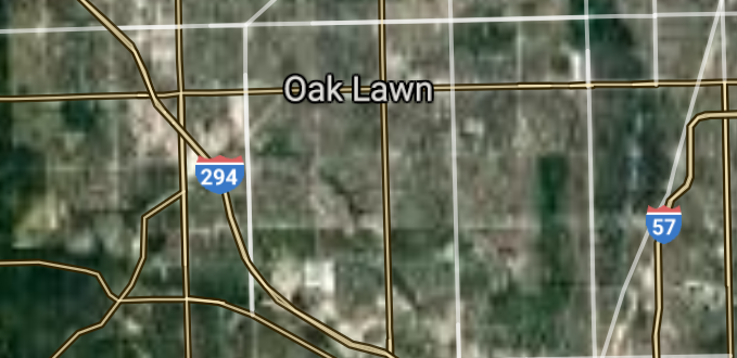
Oak Lawn [*elevation ceiling = 40km]Elevation: 187m (Group 46)
UR-100N (SLBM) |
Point A: 42.032403 00
Point B: 42.033362 00
Point C: 41.630310 00
Point D: 41.573144 00
Point E: 41.719978 00(300kt)
Point F: 41.850587 00
|
Point A: -87.741625 00
Point B: -87.883399 00
Point C: -87.853943 00
Point D: -87.793294 00
Point E: -87.747953 00(300kt)
Point F: -87.793668 00
|
|
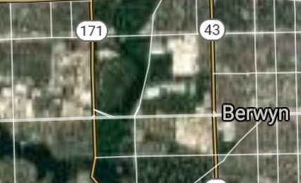
Berwyn [*elevation ceiling = 40km]Elevation: 188m (Group 46)
UR-100N (SLBM) |
Point A: 42.032403 00
Point B: 42.033362 00
Point C: 41.630310 00
Point D: 41.573144 00
Point E: 41.719978 00
Point F: 41.850587 00(300kt)
|
Point A: -87.741625 00
Point B: -87.883399 00
Point C: -87.853943 00
Point D: -87.793294 00
Point E: -87.747953 00
Point F: -87.793668 00(300kt)
|
|
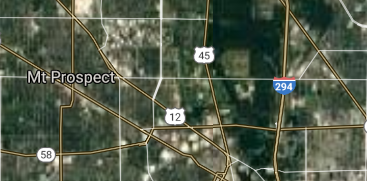
Mount Prospect [*elevation ceiling = 40km]Elevation: 203m (Group 47)
UR-100N (SLBM) |
Point A: 42.066417 00(300kt)
Point B: 41.866140 00
Point C: 40.514203 00
Point D: 42.062992 00
Point E: 41.885032 00
Point F: 41.808919 00
|
Point A: -87.937291 00(300kt)
Point B: -88.107013 00
Point C: -88.990631 00
Point D: -88.122720 00
Point E: -87.784503 00
Point F: -88.011175 00
|
|
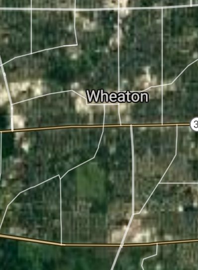
Wheaton [*elevation ceiling = 40km]Elevation: 229m (Group 47)
UR-100N (SLBM) |
Point A: 42.066417 00
Point B: 41.866140 00(300kt)
Point C: 40.514203 00
Point D: 42.062992 00
Point E: 41.885032 00
Point F: 41.808919 00
|
Point A: -87.937291 00
Point B: -88.107013 00(300kt)
Point C: -88.990631 00
Point D: -88.122720 00
Point E: -87.784503 00
Point F: -88.011175 00
|
|
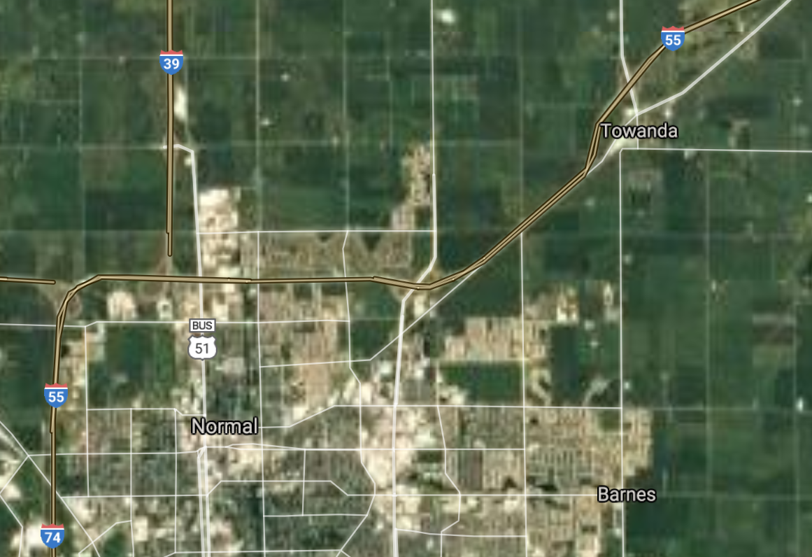
Normal [*elevation ceiling = 40km]Elevation: 246m (Group 47)
UR-100N (SLBM) |
Point A: 42.066417 00
Point B: 41.866140 00
Point C: 40.514203 00(300kt)
Point D: 42.062992 00
Point E: 41.885032 00
Point F: 41.808919 00
|
Point A: -87.937291 00
Point B: -88.107013 00
Point C: -88.990631 00(300kt)
Point D: -88.122720 00
Point E: -87.784503 00
Point F: -88.011175 00
|
|
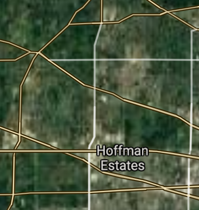
Hoffman Estates [*elevation ceiling = 40km]Elevation: 241m (Group 47)
UR-100N (SLBM) |
Point A: 42.066417 00
Point B: 41.866140 00
Point C: 40.514203 00
Point D: 42.062992 00(300kt)
Point E: 41.885032 00
Point F: 41.808919 00
|
Point A: -87.937291 00
Point B: -88.107013 00
Point C: -88.990631 00
Point D: -88.122720 00(300kt)
Point E: -87.784503 00
Point F: -88.011175 00
|
|
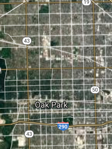
Oak Park [*elevation ceiling = 40km]Elevation: 188m (Group 47)
UR-100N (SLBM) |
Point A: 42.066417 00
Point B: 41.866140 00
Point C: 40.514203 00
Point D: 42.062992 00
Point E: 41.885032 00(300kt)
Point F: 41.808919 00
|
Point A: -87.937291 00
Point B: -88.107013 00
Point C: -88.990631 00
Point D: -88.122720 00
Point E: -87.784503 00(300kt)
Point F: -88.011175 00
|
|
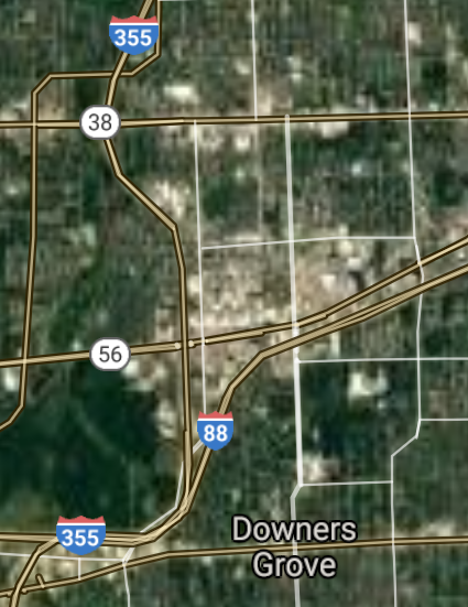
Downers Grove [*elevation ceiling = 40km]Elevation: 226m (Group 47)
UR-100N (SLBM) |
Point A: 42.066417 00
Point B: 41.866140 00
Point C: 40.514203 00
Point D: 42.062992 00
Point E: 41.885032 00
Point F: 41.808919 00(300kt)
|
Point A: -87.937291 00
Point B: -88.107013 00
Point C: -88.990631 00
Point D: -88.122720 00
Point E: -87.784503 00
Point F: -88.011175 00(300kt)
|
|
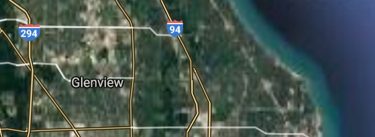
Glenview [*elevation ceiling = 40km]Elevation: 199m (Group 48)
UR-100N (SLBM) |
Point A: 42.069751 00(300kt)
Point B: 38.520050 00
Point C: 41.899474 00
Point D: 41.929474 00
Point E: 41.506700 00
Point F: 41.880030 00
|
Point A: -87.787841 00(300kt)
Point B: -89.983994 00
Point C: -87.940342 00
Point D: -88.750365 00
Point E: -90.515134 00
Point F: -88.007843 00
|
|
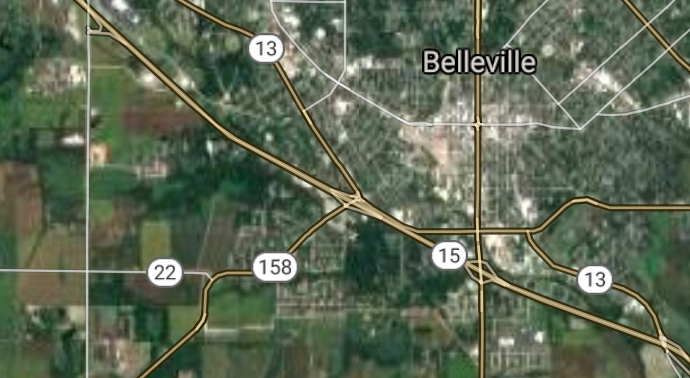
Belleville [*elevation ceiling = 40km]Elevation: 157m (Group 48)
UR-100N (SLBM) |
Point A: 42.069751 00
Point B: 38.520050 00(300kt)
Point C: 41.899474 00
Point D: 41.929474 00
Point E: 41.506700 00
Point F: 41.880030 00
|
Point A: -87.787841 00
Point B: -89.983994 00(300kt)
Point C: -87.940342 00
Point D: -88.750365 00
Point E: -90.515134 00
Point F: -88.007843 00
|
|
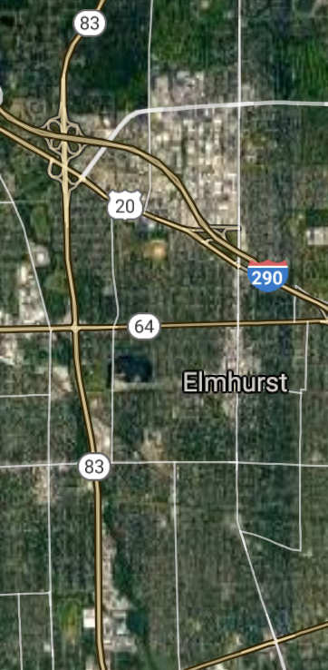
Elmhurst [*elevation ceiling = 40km]Elevation: 209m (Group 48)
UR-100N (SLBM) |
Point A: 42.069751 00
Point B: 38.520050 00
Point C: 41.899474 00(300kt)
Point D: 41.929474 00
Point E: 41.506700 00
Point F: 41.880030 00
|
Point A: -87.787841 00
Point B: -89.983994 00
Point C: -87.940342 00(300kt)
Point D:-88.750365 00
Point E: -90.515134 00
Point F: -88.007843 00
|
|
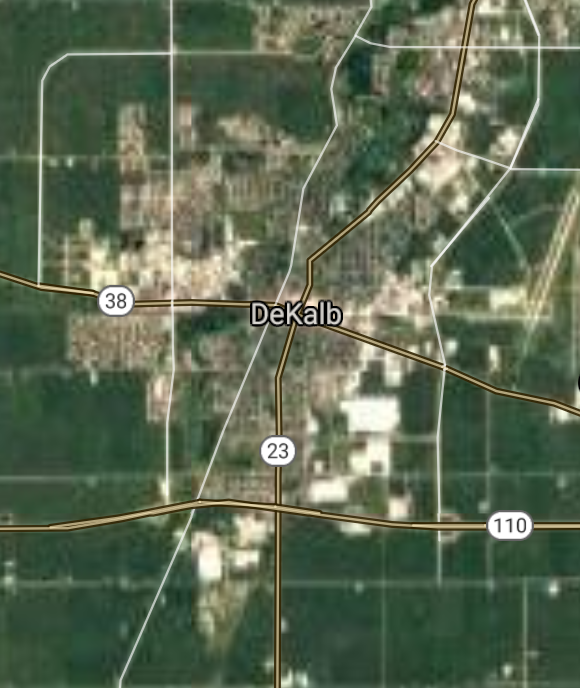
DeKalb [*elevation ceiling = 40km]Elevation: 267m (Group 48)
UR-100N (SLBM) |
Point A: 42.069751 00
Point B: 38.520050 00
Point C: 41.899474 00
Point D: 41.929474 00(300kt)
Point E: 41.506700 00
Point F: 41.880030 00
|
Point A: -87.787841 00
Point B: -89.983994 00
Point C: -87.940342 00
Point D: -88.750365 00(300kt)
Point E: -90.515134 00
Point F: -88.007843 00
|
|
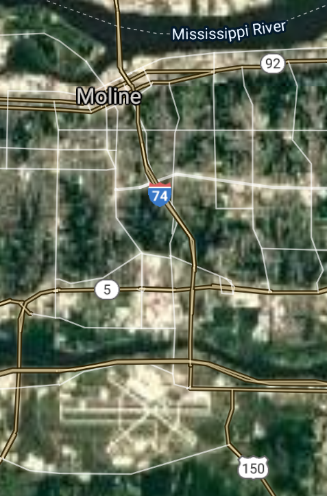
Moline [*elevation ceiling = 40km]Elevation: 177m (Group 48)
UR-100N (SLBM) |
Point A: 42.069751 00
Point B: 38.520050 00
Point C: 41.899474 00
Point D: 41.929474 00
Point E: 41.506700 00(300kt)
Point F: 41.880030 00
|
Point A: -87.787841 00
Point B: -89.983994 00
Point C: -87.940342 00
Point D: -88.750365 00
Point E: -90.515134 00(300kt)
Point F: -88.007843 00
|
|
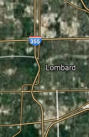
Lombard [*elevation ceiling = 40km]Elevation: 219m (Group 48)
UR-100N (SLBM) |
Point A: 42.069751 00
Point B: 38.520050 00
Point C: 41.899474 00
Point D: 41.929474 00
Point E: 41.506700 00
Point F: 41.880030 00(300kt)
|
Point A: -87.787841 00
Point B: -89.983994 00
Point C: -87.940342 00
Point D: -88.750365 00
Point E: -90.515134 00
Point F: -88.007843 00(300kt)
|
|
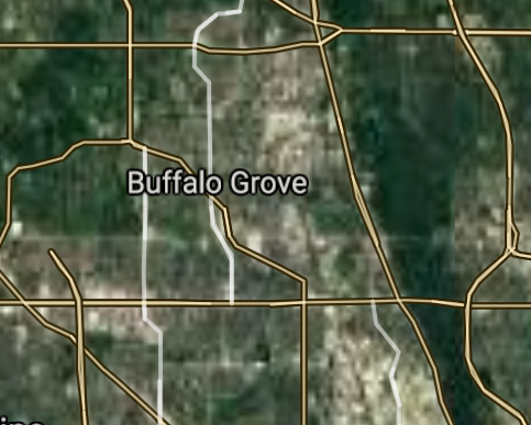
Buffalo Grove [*elevation ceiling = 40km]Elevation: 208m (Group 49)
UR-100N (SLBM) |
Point A: 42.166283 00(300kt)
Point B: 40.110588 00
Point C: 41.995028 00
Point D: 42.241134 00
Point E: 39.935602 00
Point F: 41.999472 00
|
Point A: -87.963131 00(300kt)
Point B: -88.207270 00
Point C: -88.185630 00
Point D: -88.316196 00
Point E: -91.409873 00
Point F: -88.145073 00
|
|
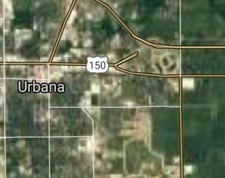
Urbana [*elevation ceiling = 40km]Elevation: 223m (Group 49)
UR-100N (SLBM) |
Point A: 42.166283 00
Point B: 40.110588 00(300kt)
Point C: 41.995028 00
Point D: 42.241134 00
Point E: 39.935602 00
Point F: 41.999472 00
|
Point A: -87.963131 00
Point B: -88.207270 00(300kt)
Point C: -88.185630 00
Point D: -88.316196 00
Point E: -91.409873 00
Point F: -88.145073 00
|
|
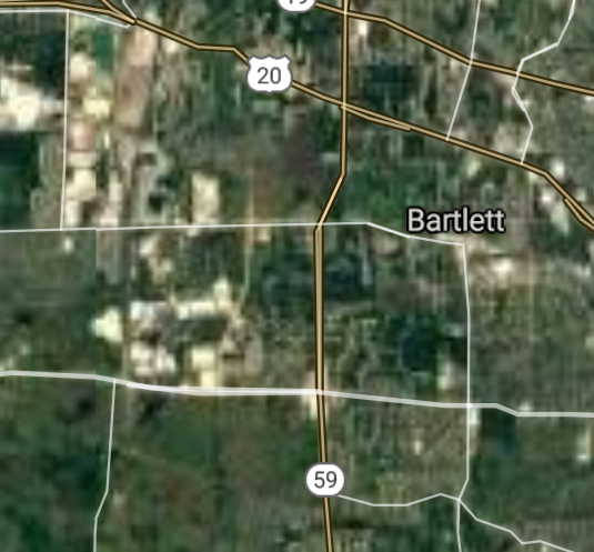
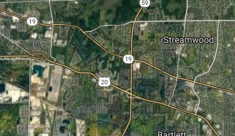
Bartlett [*elevation ceiling = 40km]Elevation: 246m (Group 49)
UR-100N (SLBM) |
Point A: 42.166283 00
Point B: 40.110588 00
Point C: 41.995028 00(300kt)
Point D: 42.241134 00
Point E: 39.935602 00
Point F: 41.999472 00
|
Point A: -87.963131 00
Point B: -88.207270 00
Point C: -88.185630 00(300kt)
Point D: -88.316196 00
Point E: -91.409873 00
Point F: -88.145073 00
|
|
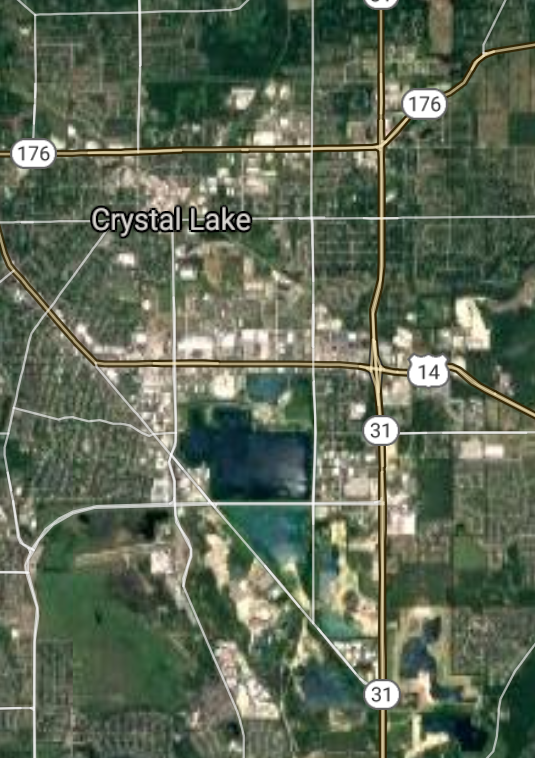
Crystal Lake [*elevation ceiling = 40km]Elevation: 277m (Group 49)
UR-100N (SLBM) |
Point A: 42.166283 00
Point B: 40.110588 00
Point C: 41.995028 00
Point D: 42.241134 00(300kt)
Point E: 39.935602 00
Point F: 41.999472 00
|
Point A: -87.963131 00
Point B: -88.207270 00
Point C: -88.185630 00
Point D: -88.316196 00(300kt)
Point E: -91.409873 00
Point F: -88.145073 00
|
|
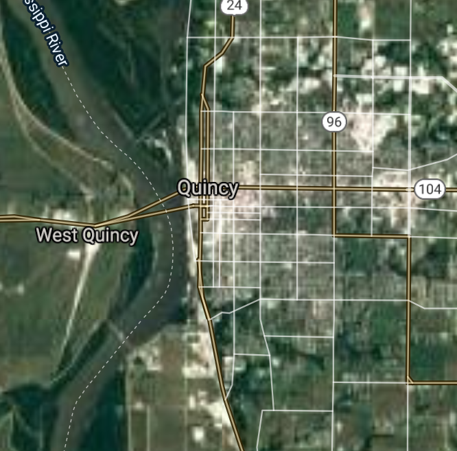
Quincy [*elevation ceiling = 40km]Elevation: 173m (Group 49)
UR-100N (SLBM) |
Point A: 42.166283 00
Point B: 40.110588 00
Point C: 41.995028 00
Point D: 42.241134 00
Point E: 39.935602 00(300kt)
Point F: 41.999472 00
|
Point A: -87.963131 00
Point B: -88.207270 00
Point C: -88.185630 00
Point D: -88.316196 00
Point E: -91.409873 00(300kt)
Point F: -88.145073 00
|
|
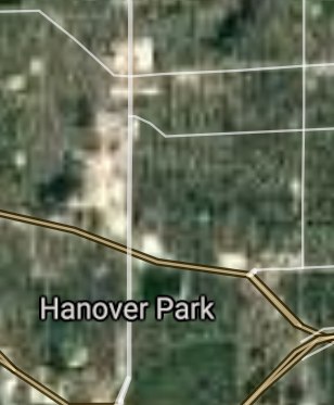
Hanover Park [*elevation ceiling = 40km]Elevation: 244m (Group 49)
UR-100N (SLBM) |
Point A: 42.166283 00
Point B: 40.110588 00
Point C: 41.995028 00
Point D: 42.241134 00
Point E: 39.935602 00
Point F: 41.999472 00(300kt)
|
Point A: -87.963131 00
Point B: -88.207270 00
Point C: -88.185630 00
Point D: -88.316196 00
Point E: -91.409873 00
Point F: -88.145073 00(300kt)
|
|
Streamwood [*elevation ceiling = 40km]Elevation: 248m (Group 50)
UR-100N (SLBM) |
Point A: 42.025583 00(300kt)
Point B: 41.912529 00
Point C: 41.647531 00
Point D: 41.632223 00
Point E: 41.509477 00
Point F: 42.121136 00
|
Point A: -88.178408 00(300kt)
Point B: -88.134793 00
Point C: -88.089506 00
Point D: -88.212031 00
Point E: -90.578748 00
Point F: -88.257858 00
|
|
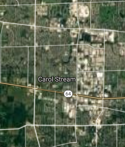
Carol Stream [*elevation ceiling = 40km]Elevation: 232m (Group 50)
UR-100N (SLBM) |
Point A: 42.025583 00
Point B: 41.912529 00(300kt)
Point C: 41.647531 00
Point D: 41.632223 00
Point E: 41.509477 00
Point F: 42.121136 00
|
Point A: -88.178408 00
Point B: -88.134793 00(300kt)
Point C: -88.089506 00
Point D: -88.212031 00
Point E: -90.578748 00
Point F: -88.257858 00
|
|
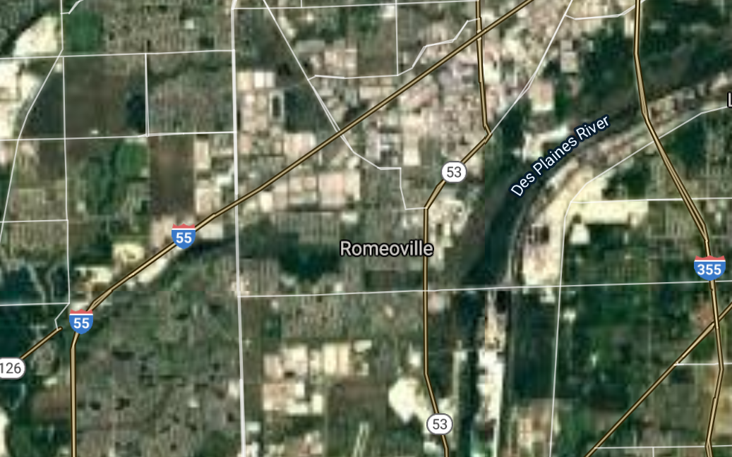
Romeoville [*elevation ceiling = 40km]Elevation: 189m (Group 50)
UR-100N (SLBM) |
Point A: 42.025583 00
Point B: 41.912529 00
Point C: 41.647531 00(300kt)
Point D: 41.632223 00
Point E: 41.509477 00
Point F: 42.121136 00
|
Point A: -88.178408 00
Point B: -88.134793 00
Point C: -88.089506 00(300kt)
Point D: -88.212031 00
Point E: -90.578748 00
Point F: -88.257858 00
|
|
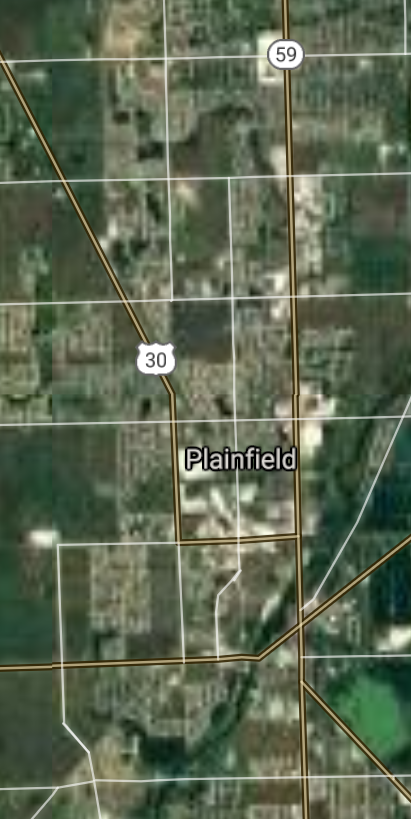
Plainfield [*elevation ceiling = 40km]Elevation: 190m (Group 50)
UR-100N (SLBM) |
Point A: 42.025583 00
Point B: 41.912529 00
Point C: 41.647531 00
Point D: 41.632223 00(300kt)
Point E: 41.509477 00
Point F: 42.121136 00
|
Point A: -88.178408 00
Point B: -88.134793 00
Point C: -88.089506 00
Point D: -88.212031 00(300kt)
Point E: -90.578748 00
Point F: -88.257858 00
|
|
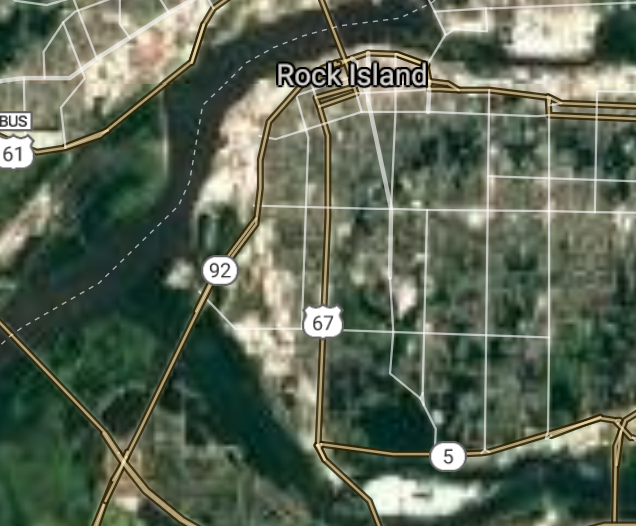
Rock Island [*elevation ceiling = 40km]Elevation: 172m (Group 50)
UR-100N (SLBM) |
Point A: 42.025583 00
Point B: 41.912529 00
Point C: 41.647531 00
Point D: 41.632223 00
Point E: 41.509477 00(300kt)
Point F: 42.121136 00
|
Point A: -88.178408 00
Point B: -88.134793 00
Point C: -88.089506 00
Point D: -88.212031 00
Point E: -90.578748 00(300kt)
Point F: -88.257858 00
|
|
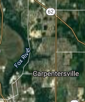
Carpentersville [*elevation ceiling = 40km]Elevation: 271m (Group 50)
UR-100N (SLBM) |
Point A: 42.025583 00
Point B: 41.912529 00
Point C: 41.647531 00
Point D: 41.632223 00
Point E: 41.509477 00
Point F: 42.121136 00(300kt)
|
Point A: -88.178408 00
Point B: -88.134793 00
Point C: -88.089506 00
Point D: -88.212031 00
Point E: -90.578748 00
Point F: -88.257858 00(300kt)
|
[Top]
Open START Drills: Central Basin
|
|
|
|
|
|
 Bottom Line Drill
 Per-Day Drill
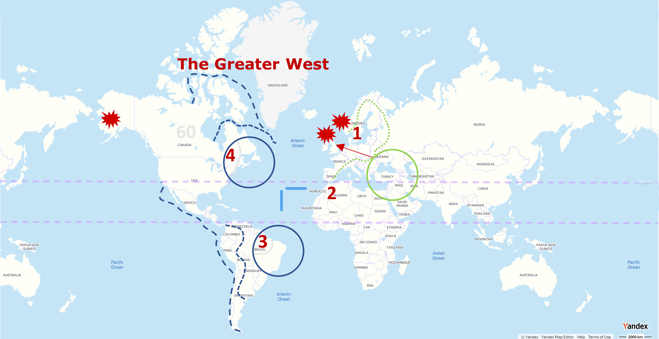
 Rules of Engagement Drill